CENTRAL NEW YORK SEVERE WEATHER ALERTS Click On County For Details
Front Yard Cam


Click Icon refresh For Large View
Back Yard Bird Cam


Click Icon refresh For Large View
Radar Loop
CNYWeather Doppler Radar

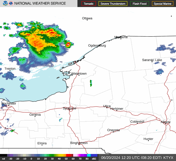
Click Here for Radar Loop
No Weather Records Have Been Established For This Station Today as of 05:55 AM


CENTRAL NEW YORK FORECAST DISCUSSION SYNOPSIS Forecast Discussion for BGM NWS Office
SYNOPSIS... Humidity will be increasing today with a hot and muggy
afternoon expected for Independence day. A few scattered showers and
thunderstorms develop in the Southern Tier into NE PA this afternoon and
overnight that could impact some firework displays. Muggy conditions last
into Friday with continued risk of thunderstorms into the weekend. 

NWS BGM Office Area Forecast Discussion

OSZAR »

LIVE Data Updated Every 30 Seconds:   Thu, 04-Jul-2024 5:55am EDT  
Temperature Current Conditions National Weather Service Forecast

Currently:

71.8°F

Trend:Colder 0.5°F than last hour. /hr
Heat Index   72°F
24-hr temp diff 6.3°FWarmer 6.3°F than yesterday at this time.
---
High Today
76.6°F
12:00am
Low Today
71.8°F
5:02am
Yesterday
85.5°F
Yesterday
62.4°F
Last Year
86.5°F
Last Year
63.4°F
CNYWeather Data Since 2006
Average High
81.6°F
Average Low
57.1°F
Record High
94.2°F
2018

Record Low
48.0°F
2022

Avg Temp
Jul 2024
69.2°F
Avg Temp
Jul 2006-24
70.4°F

Overcast, Dry
Overcast, Dry

Wind from SW SW  
1.1
Gust:
1.1
Light Air
Gust Today: 6.9 mph 12:02am
Gust Yesterday: 22 mph 12:58pm
This Month: 21.5 mph Jul 3
This Year: 39.1 mph on Jan 9
Station Record: 58.5 mph Jul 5, 2013
Chandler Burning Index: LOW Current
Fire Danger:
1.2 of 100
Click For Full Forecast
Overnight

Overnight: Chance Showers And Thunderstorms
Chance Showers And T-Storms

Lo 69 °F
Independence
Day
Independence Day: Chance Showers And Thunderstorms then Partly Sunny
Chance Showers And T-Storms then Partly Sunny

Hi 87 °F
Thursday
Night
Thursday Night: Mostly Cloudy then Patchy Fog
Mostly Cloudy then Patchy Fog

Lo 65 °F
Hazardous Weather Outlook
NWS Binghamton Hazardous Weather Outlook
Dew Point Liquid Precipitation/Snowmelt Wind Sun/Moon
Dew Point: Increased 1°F since last hour. 64.9°F
In Last Hour: Increased 1°F since last hour. 1°F
High Dew
Point:
65.5°F
at 3:02 AM
Low Dew
Point:
62.2°F
at 12:02 AM
Record Dew
Point:
89.1°F
Aug-22-2021
Wetbulb: 67.4°F
Resets at 7am: 0.00 in
Yesterday: 0.00 in
Last 7 Days: 2.03 in
July Rain: 0.00 in
July Avg: 5.41 in
Diff from Avg: Under 5.41 in for the month -5.41 in
Rain Season:1 25.12 in
Last YTD Rain:1 23.66 in
Season Diff: Over 1.46 in for the month 1.46 in
Last Rain
Time/Date:
7/1/2024
at 12:22 AM
2 days since last rain
Currently: SW at
1.1 mph
Gusting To: 1.1
Max Gust: 6.912:02 AM
1Hr Average: 1.1 mph
Month Gust: 21.5 mph Jul 3
Year Gust: 39.1 mph Jan 9
Record Gust: 58.5 mph
on 5-Jul-2013
Wind Run: 8.28 miles
Daylight:
Possible hours of Daylight
15:16
-0:51
Min:Sec

Sunrise:
5:28 am
Sunset:
8:44 pm

Waning Crescent
Waning Crescent, 27 days, 21 hours, 21 minutes in cycle
3%
Illuminated
Humidity Barometer
Humidity: Increased 4% since last hour. 79 %
In Last Hour: +4%
High
Today
80%
at 5:46 AM
Low
Today
61%
at 12:02 AM
Current: Rising 0.004  inHg/hr 30.076 inHg
In Last Hour: Steady
High
Today:
30.085
at 12:59 AM
Low
Today:
30.064
at 4:28 AM
Cooling Degree Days Snow (0.01" is Trace) Heat Index Air
Today: 2.2
July: 13.9
2024 to Date: 192.1
Heating Degree Days
2024 to Date: 3662.7
Today at 7am: 0.00 in
Yesterday: 0.0 in
July: No Change 0.0 in
July Avg: 0.0 in
Diff from Avg: 0.0 in
Season Total:2 0.0 in
Snow Depth: 0.0 in
0 snow day in July
0 snow day this season.2
Current: 72.4°F
Today: 76.6°F 
Yesterday: 88.8°F
Record: 126.3°F
Aug-22-2021
Quality
Index6:

50


Good
Density:
1.19 kg/m3
Current UV Index Current Solar Energy
0.0
Sunburn in
720 Minutes
Highest:
12:00 AM
0.0
12 W/m2
0%
W/m2 SI Solar % SI
High Today:
5:54 AM
12  W/m2
Record:
1461 W/m2
Almanac Soil Conditions Station All Time Records Outlook
In Temp: °F 
In Hum:  
In Air Quality: Good
AQI: 20.8
Particulate matter/PM: 5.0
Full Moon: June 22 2024
New Moon: 22:58 UTC July 5 2024
Current ET: 0.06 in
7-Days Rain: 2.03 in
7-Days ET: 1.09 in
7-Day: 0.943 in 0.943 water in excess of what evaporated in last 7 days.
Diff from Avg: 0.0 in
July:  0.66 in water in deficit of what evaporated this month. -0.66 in
Cloud Height: 2136 ft
HIGHS: LOWS:
97.5°F
01-Jul-2018
-22.5°F
14-Feb-2016
6am-6pm Avg Temp Record
  96.6°F
01-Jul-2018
  -11.0°F
14-Feb-2016
6pm-6am Avg Temp Record
  83.3°F
22-Jul-2011
  -15.2°F
14-Feb-2016
ICN:18 | S3C2:1
ISS:Ok |
Independence
Day
Independence Day: Chance Showers And Thunderstorms then Partly Sunny
Chance Showers And T-Storms then Partly Sunny
1 Rain season: Jan 1st to Dec 31st.   
2 Snow season July 1st to June 30th.    3 Snow manually measured usually around 7AM.   
5 Estimated amount of water needed to replace the water used by plants and evaporation from the past week.
6 Air Quality Index is provided by AirNow.gov and is updated hourly between the hours of 6AM and Midnight.
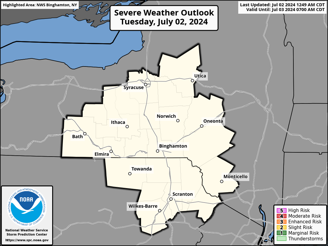
 NWS Weather Forecast  -   Outlook Overnight & Independence Day
Overnight

Overnight: Chance Showers And Thunderstorms
Chance Showers And T-Storms

Lo 69 °F
NWS forecast: A chance of showers and thunderstorms. Mostly cloudy, with a low around 69. Southwest wind around 5 mph. Chance of precipitation is 40%. New rainfall amounts between a tenth and quarter of an inch possible.
Independence
Day
Independence Day: Chance Showers And Thunderstorms then Partly Sunny
Chance Showers And T-Storms then Partly Sunny

Hi 87 °F
NWS forecast: A chance of showers and thunderstorms before 8am, then a slight chance of showers and thunderstorms between 8am and 9am. Partly sunny, with a high near 87. Southwest wind 2 to 6 mph. Chance of precipitation is 40%. New rainfall amounts between a tenth and quarter of an inch possible.
 NWS Short Term Weather Forecast
Thursday
Night
Thursday Night: Mostly Cloudy then Patchy Fog
Mostly Cloudy then Patchy Fog

Lo 65 °F
Friday

Friday: Mostly Sunny then Slight Chance Showers And Thunderstorms
Mostly Sunny then Slight Chance Showers And T-Storms

Hi 90 °F
Friday
Night
Friday Night: Showers And Thunderstorms Likely
Showers And T-Storms Likely

Lo 71 °F
Saturday

Saturday: Showers And Thunderstorms Likely
Showers And T-Storms Likely

Hi 88 °F
Saturday
Night
Saturday Night: Chance Showers And Thunderstorms then Partly Cloudy
Chance Showers And T-Storms then Partly Cloudy

Lo 65 °F
Sunday

Sunday: Mostly Sunny
Mostly Sunny

Hi 82 °F
Sunday
Night
Sunday Night: Mostly Clear
Mostly Clear

Lo 62 °F
Countdown to Fall
 Autumn Equinox begins September 22nd at 8:44am   EDT  


USA Weather Finder

OSZAR »